Special Hike Report: Boise and Bogus Basin

Hike report by Leigh Ann

From June 25 – June 30, my husband John and I were in the Boise, ID, area. We chose Boise because we wanted to do something memorable for our 25th anniversary, and I’d never been to Idaho. We divided our time between walking around the downtown-Boise State U. area and hiking on trails in Bogus Basin, which is north of town. I think Righteous Basin is a better name.

The weather for the first few days was completely clear and the sky was so dark it looked like the underside of a turquoise bowl. In the pictures where the sky is darker than the land, that’s not the camera being weird. The dark blue persisted once some clouds came in a few days into our trip. High temperatures were — and remember that it was a dry heat, so you didn’t sweat, you just grew salt crystals — 94 to 104 degrees, depending on the day. It was surprisingly not oppressive. And for a week or two before we arrived, Boise had gotten an unusual amount of rain. This meant the grasses and wildflowers were unusually lush.

In the town itself, there are lots of trees. Boise’s town planners long ago decided it would be a good idea to have 25 miles of walking and biking paths through woods, parks, and other green spaces along the Boise River, and some of the pictures show how green it is. Boise has a population of about 600,000, which is half the state’s population. There were many pride flags, interesting art, a memorial park to Anne Frank that is in the picture where John is reading the memorial, a great farm-to-fork restaurant, and an excellent boutique hotel (Inn at 500 Capital Street) that was also friendly and affordable.

Heading away from town to the north you get to sagebrush steppe hills, which were astonishing. We saw at least 15 kinds of grasses and many kinds of wildflowers, some of which are in the pictures of a low altitude (appx. 3,000 feet) trail we hiked in Bogus Basin on our first day there: the ironically named Dry Creek Trail. We made up names: art deco green spire grass, iridescent ponytail grass, fluffy chartreuse waterfall grass, blue wavy grass, mauve bushy top grass, and so on. We couldn’t walk more than 10 feet without stopping to look at more grass.

Farther up in the hills, above about 5,000 feet, is where the pine forest starts. John and I did most of our hiking here, specifically on Freddy’s Stack Rock Trail. This is a 12.5-mile lollypop-shaped trail that has lots of views but surprisingly little elevation change. It snakes along many hills, each of which has two microclimates. On the north-facing slopes are pine and hardwood forests that are refreshingly shady. These get enough mist that club moss grows on the pines, which look like Muppet trees. On the south-facing slopes is sagebrush steppe with expansive views. Stack Rock is a large formation at the far end of the round part of the lollypop. If you pull in on the nobbier part of it in the picture, you can see a guy free soloing it. It’s bigger and a lot taller than it might seem.

John and I would go back to Boise, especially at the time of year we went. This is because we’re more into hiking than downhill skiing, which is also a big deal there.

Special Hike Report: White Mountains

Hike report by Nancy L.

After visiting our son Nathan, daughter-in-law Bri, and our 4-month-old granddaughter Eliza in Boston, Randy and I camped at Lafayette Place campground in New Hampshire.

The campground was all right but somewhat noisy because of its proximity to a super highway.  

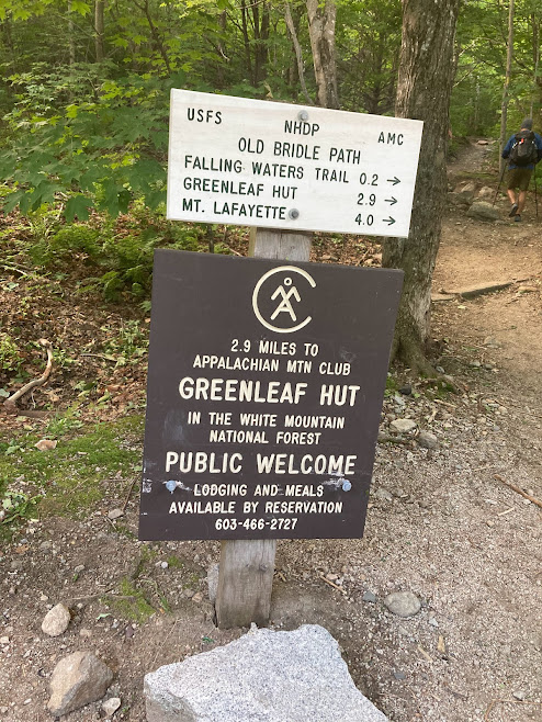
In the morning we set off up to the Greenleaf hut, which is at the base of Mt. Lafayette. As we went up, the going got rougher, with boulders to navigate at every step.  

But after a 2,500′ elevation gain we arrived at the hut, a very nice place where you can reserve a sleeping mat in a bunk bed along with dinner and breakfast for about $135 a night.  

We enjoyed our lunch with a grand view and headed back down, which was the hardest part.

All photos by Nancy L. and Randy O. There are lots more beautiful pictures in their photo album.

My Top Twelve Hikes: Summer 2022

I was reviewing some of the older pages here last night while I sat in on Nancy H’s writing group on Meetup. After reviewing Stephens older post on his personal favorite top 12 hikes I decided it was a good time for me to compile my own list. I’ll probably have more commentary associated with my choices than Stephen had for his.

In no particular order:

1- Monkey Run, North side. Currently hike #5-01 on our hikes page. This is one of our go-to hikes that we’ve done repeatedly since I’ve been with the group, and it never fails to be a fun hike for me.

2- Kennedy State Forest. Cortland county. Hike # 36-1. Another of our hike standards. I was worried that recent logging work in the area would ruin the appeal of this hike for me, but the logging had minimal impact on the FLT footpath through the forest.

3- Shindagin Rim Trail. Hike #26. A very visually enjoyable hike for me.

4- Monkey Run south side. Hike #6. This route has so much to offer in terms of visuals and just sheer fun for me while I’m hiking this trail!

5- Six Mile Creek South Hill Rec Way from Crescent. Hike #2. While the hike route itself is very nice in its own right, I’m always amazed that this hike exists so close to the city of Ithaca.

6- Lower Treman Loop. Hike #8-02. I took the existing lower Treman out-and -back FLT hike and made it a loop hike by adding the Rim and Gorge Trails. I worked at the two Treman state parks for many years in the 70s and 80s, and this hike covers parts of my favorite trails in Robert Treman State Park.

7- Hammond Hill State Forest. Hike # 31-5. A recent addition to our hike options for Hammond Hill, this route covers just about all of my favorite parts of the state forest as it starts from Star Stanton Hill Rd and takes hikers in a clockwise loop hike over the green and yellow trails.

8- Potato Hill State Forest Hike #29-1. The FLT from Level Green Rd to Blackman Hill Rd and beyond. This hike has only gotten better after the recent footpath changes.

9- Virgil Mountain, Cortland County. Hike #40. I’m not normally a fan of the out-and-back hikes, but I like this one.

10- Dabes Diversion Loop, Cortland County. Hike #48-1. Combines Dabes Diversion Loop, the FLT and the Kuzia Cutoff into a fun loop hike in any season. Some nice views across the fields at the junction of Dabes and the FLT!

11- The FLT from Eastman Hill Rd, Tompkins/ Tioga county line. Hike # 50. While parts of the abandoned parts of Eastman Hill Rd make this loop hike somewhat sketchy in bad weather, the rest of the hike makes up for it. We’ll be losing this part of the FLT soon due to a trail re-direction.

12- Loop Trail: Bald Hill Rd to Dianes Crossing and back on the FLT. Hike # 20. Combines parts of the Abbott Loop, Doves Trail and the FLT into a loop hike worthy of being on my favorites list.

Honorable mention:

13- Fischer Old Growth Forest. Hike #15. This is a great hike locale, but the fact that we can’t *quite* get a two hour hike out of this one keeps it out of my top 12 list

14- Lick Brook. Hike # 7. This hike is a favorite for many hikers in the group, but for whatever reason doesn’t quite make my top 12 list.

15- Lime Hollow, Cortland County. Hike #37. While this is a little more of a “civilized hike” than the others on the list, we have a nice route we hike in this nature preserve that I find very enjoyable.

A Celebration of Stephen and Susan

Saturday June 4

A Party to Say Thank You and Farewell

Note: The original link to Annie’s video (see below) didn’t work, so I’ve replaced that link with a new one. Several people have tested the new link and were able to view the video. Enjoy!

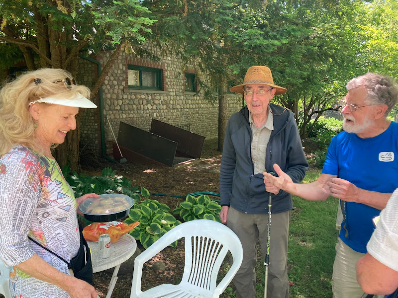
After Saturday’s hike, friends old and new gathered at Roger’s beautiful home to say thank you and goodbye to Ithaca Hikers’ longtime leaders Stephen and Susan Hesse, who are moving to Rhode Island to be closer to family. We didn’t do an official head count, but multiple people estimated that more than 50 current or former hikers dropped by.

Since taking over organization of the group in 2004, Stephen and Susan have expanded the number of weekly hikes, scouted out dozens of perfectly timed two-hour hikes throughout our region, and helped to organize social events beyond time spent on the trails. They always welcomed new hikers with grace and enthusiastic interest, making newcomers feel part of the group from their very first hike.

Stephen has compiled an illustrated history of the Ithaca Hikers. If you haven’t read it yet, it’s worth your time.

Saturday afternoon was the sort of beautiful spring day we’re lucky to experience in Ithaca. The day was sunny and pleasantly warm, with a lively breeze. At the party, guests made good use of the grills available for cooking. Guests were encouraged to bring their own food and drink, but many brought food to share.

People socialized for about an hour before Roger asked for everyone’s attention. He and several others shared memories of Stephen and Susan–times shared, recollections of specific hikes, and reminiscences of what made hiking with Stephen and Susan so much fun. It was remarkable to take stock of what the Hesses had built–the friends, the laughter, the shared memories, the echoes of Stephens loud “YO!” to get everyone’s attention–and to know that Ithaca Hikers is still going strong. We will miss them, but we will carry their legacy far into the future.

The party continued through the afternoon, with guests enjoying the pond and a clambake.

Hiker, photographer, singer, and all-around extraordinary person Annie W. compiled a video with photos she took over a period of several years, set to a soundtrack performed by Choir of the Earth (with Annie a participating singer). It is a beautiful and moving tribute, and you can view it here: https://photos.app.goo.gl/8XeMGcGW3XMxRLMk6 (If you don’t immediately see the Play button, look for it in the upper right corner.) The singing is gorgeous, and the photos really capture the essence of our group. Thank you, Annie!

And thank you, Stephen and Susan, for everything you’ve done for the Ithaca Hikers. You created something remarkable and nurtured it into a strong and thriving group. It has meant so much to every one of us who have been lucky enough to hike with you. We wish you much happiness as you set out on your next trail!

Photos by Cian
Photo by Norm

Photos by Leigh Ann

Photos by Randy S.

View Cian’s photo album

View Leigh Ann’s photo album

Announcing a lively new feature for our web site

Hello Hikers!

Posted by shesse

Jim and Nancy H have been actively trying to bring new people into our group through the Meetup app, and having a good deal of success; seems like we get some new faces every week. Jim said that he can often hear newer members chatting behind him and asking about the background and history of the group, which has never been documented and has always been a bit murky to everyone. So Jim asked me if I could package something up that will give outsiders an idea of who we are ands how the group evolved. Here it is:

An illustrated history of the Ithaca Hikers

This history will always be available on the web site in the “MENU” widget — click the drop-down and you’ll see the heading. Sometimes history can be dull; I definitely focused on trying to make this one lively. Hope I succeeded.