Wednesday, July 22
Finger Lakes Trail from White Church Rd., Brooktondale
Hike report by Kathy K
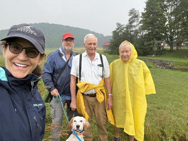
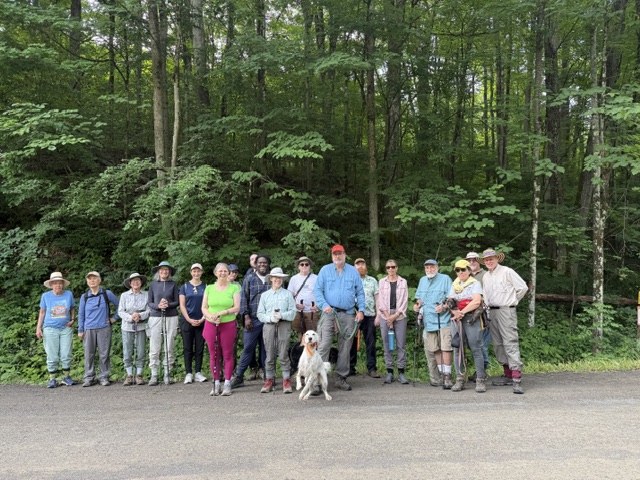
8 hikers and 1 dog met at the parking area 4 miles south of Brooktondale area, where the FLT crosses White Church Road.
Lovely day for the classic hike #24: a big T-shaped out-and-back hike. FLT west across the field to the old railroad path, a mile south on FLT to end of White Church Rd where it ends at Coddington Rd, turn around and go north on the railroad path about 2 miles (a mile past the turn to the field) to Ridgeway Rd (second mile is no longer part of FLT after it was rerouted), then back a mile to the path to the field and our cars
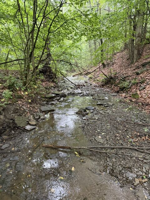
Very pretty scenery and views of the swamps next to the trail. But the paths is all somewhat overgrown with invasive honeysuckle and wild rose and ,,, Jim will reach out and find out who/if the trail is being maintained; some of us may go do some pruning…
The rail trail portion will eventually become part of the Coddington Valley Rail Trail as it gets completed from Burns Road to White Church Rd. We did peek at the path heading north from Ridgeway Road. It’s been covered in water for years now; will be interesting to see how the rail trail gets connected there.


Saturday, July 25
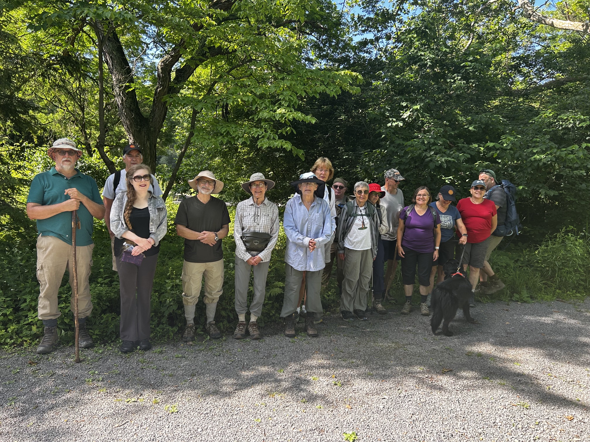
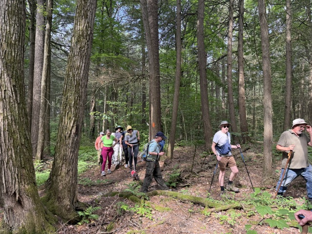
Finger Lakes Trail through Lower Treman
Hike report by Leigh Ann
Sixteen hikers and two dogs on leashes did all or part of this annual 5.25-mile, pre-cookout hike. This circle route starts at the parking lot for the Tappan Mitra preserve off of 13, goes west on the FLT to the picnic shelter (to bypass the campground), and cuts over to the Treman south rim trail. From there, it goes west to the bridge near the base of Lucifer Falls, crosses the bridge, and takes the gorge trail all the way to where it ends at the parking lot for the lower falls. Then we walk back to the FLT on the road that leads through the campground and take the FLT back to the cars. This hike has about 775 feet of elevation gain and takes about 2 hours 15-20 minutes to do, depending on how many stops we make. But this slightly longer hiking time works great for arriving at the cookout at noon.
Here are some pictures I took at the cookout: https://photos.app.goo.gl/gDBk8HJAoTp7WUKy7
Roger and Gunilla, thanks for opening your home and your gorgeous lands to the hikers for yesterday’s cookout, to the many people who helped with set up, cooking, and clean-up, and to the many new and old friends who were there. It was a beautiful day for this cookout, too: no thunderstorms or smoke.


Sunday, July 26
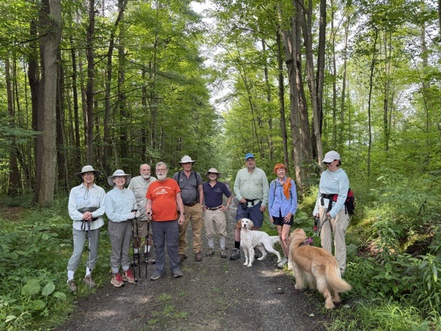
Roy H Park Preserve to Hammond Hill State Forest, Dryden
Hike report by Nina F.
Eleven hikers and four dogs met at the north parking lot of the Roy H. Park Preserve to hike out to Hammond Hill State Forest. Fun fact: Roy Park provided a grant to hike leader (Nina) for bat research that she and husband/co-hike leader Steve conducted many years ago on Rafinesque big-eared bats in Virginia. Mr. Park apparently was a bat enthusiast.
The beginning of the hike is gorgeous, taking you along boardwalks above the marsh before leaving the Preserve and moving into the state park, where we followed the red DEC trail marker discs. The trail is lovely there as well, with pine needles covering the path and nice pine trees throughout. After a mile and a quarter, we crossed Hammond Hill Road to continue on more wooded trails. After checking with everyone’s schedules, we walked a slightly longer than usual route, so the hike ended about 15 minutes late and was over five miles. Luckily, the trail was shady for most of the hike, which was helpful as the temperature climbed.
There are a fair number of people who use this trail system and we passed quite a few other hikers and dogs.