Wednesday, January 14
Connecticut Hill, Newfield
Hike report by Nancy Lorr
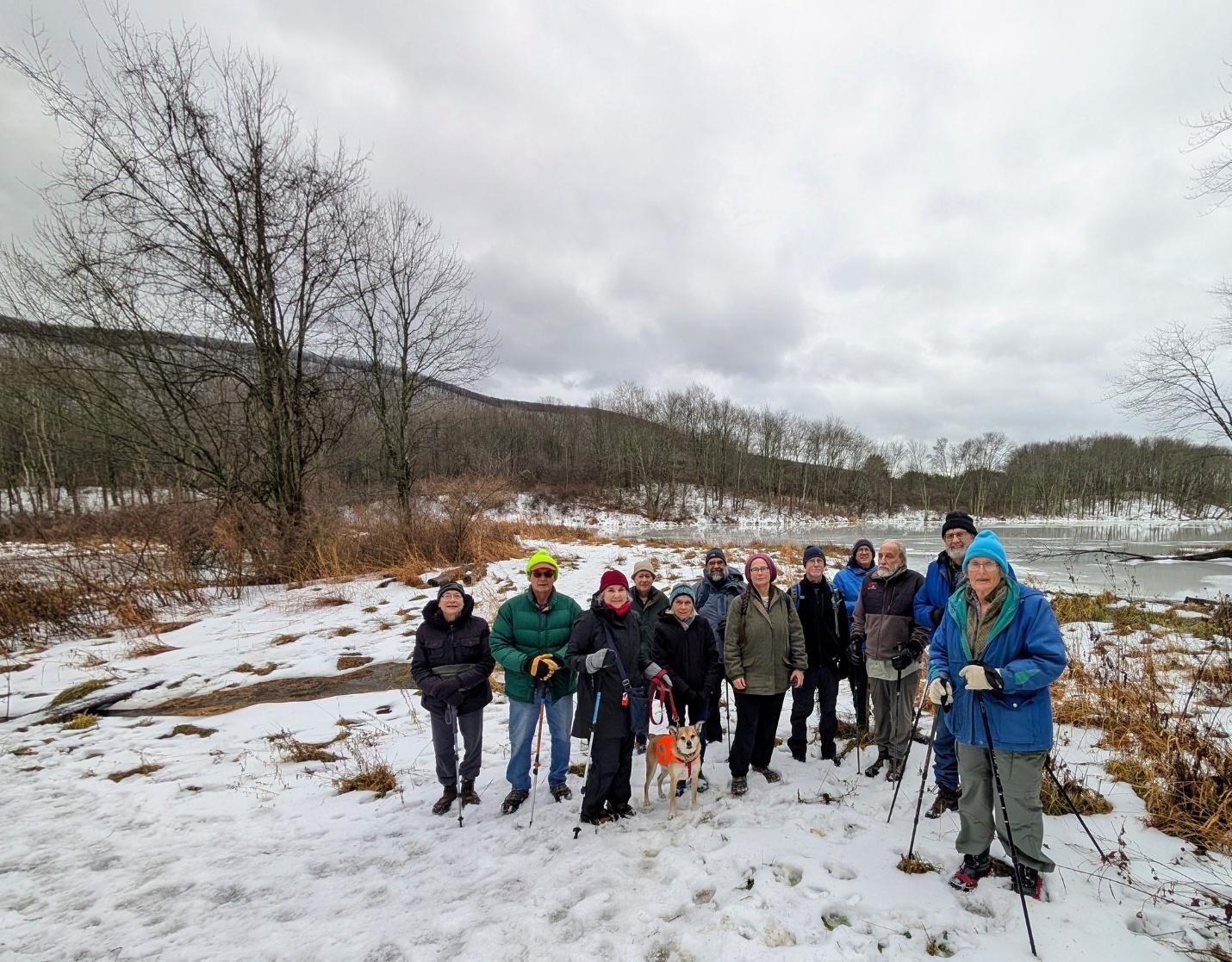
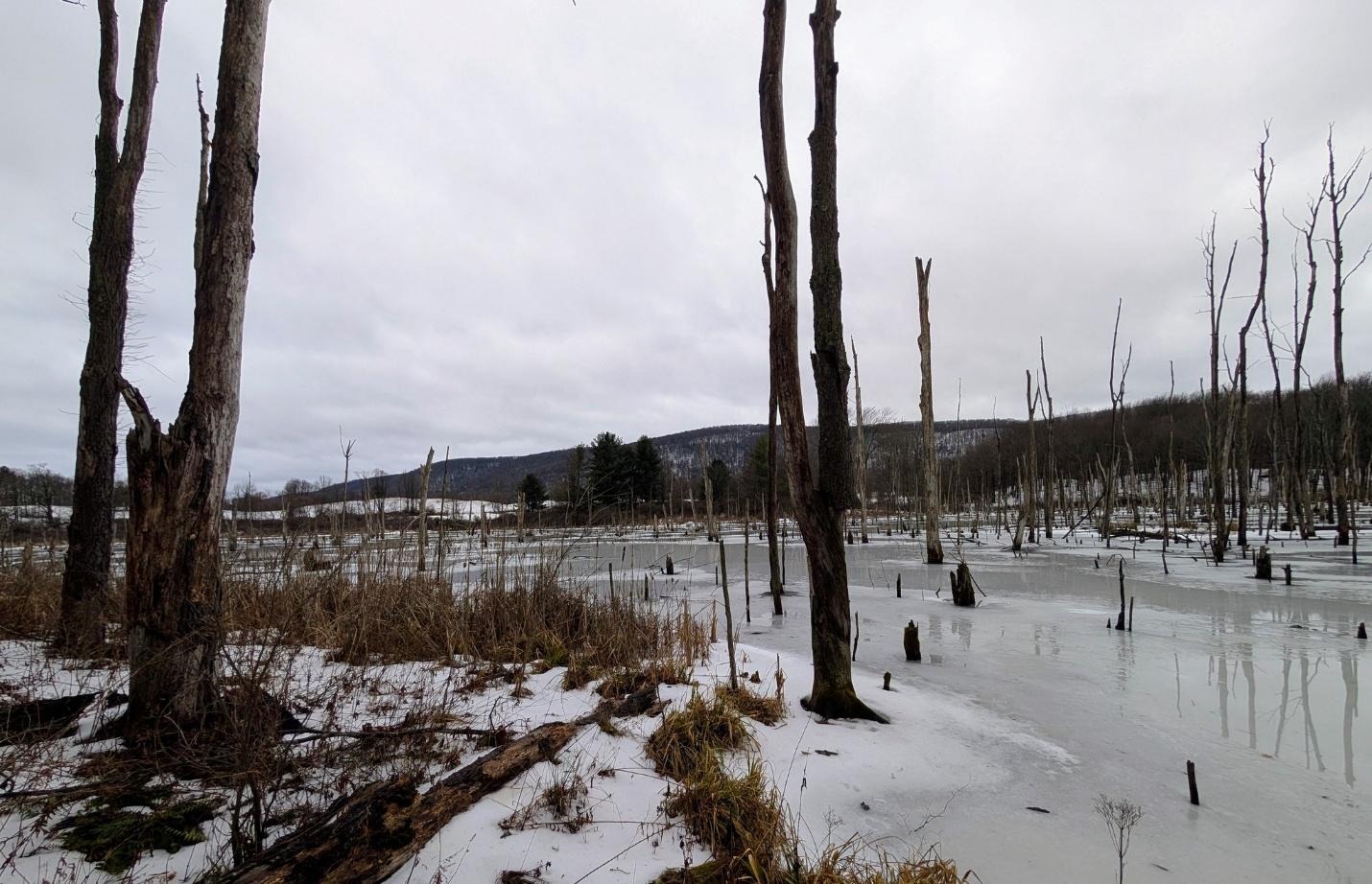
18 hikers and 2 dogs gathered at the corner of Lloyd Stark Boylan and Connecticut Hill Roads for an exploration of un marked trails on Rowell Hill. a glimpse of the frozen beaver pond was taken before returning to the cars

Saturday, January 17
Ekroos Rd. at the Tompkins/Tioga County Line
Hike report by Jim
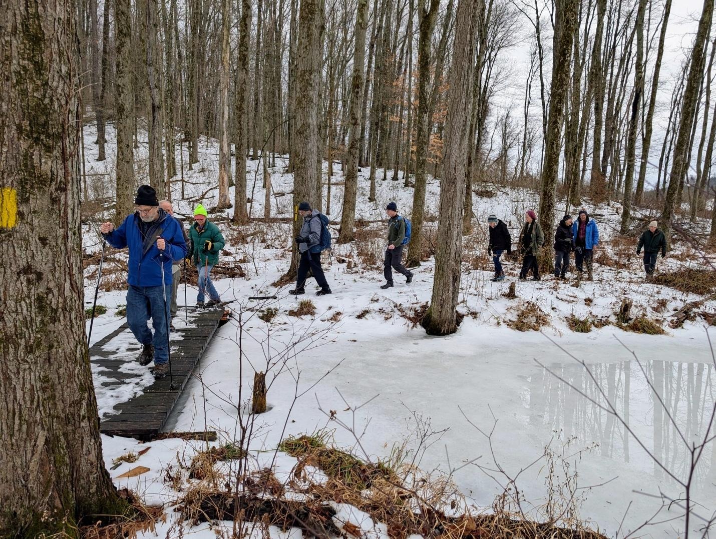
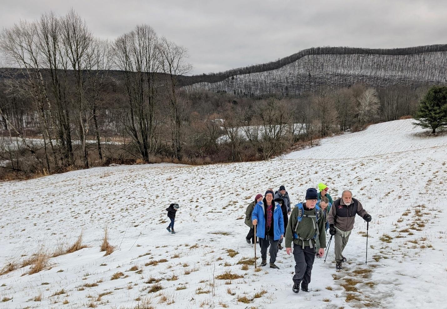
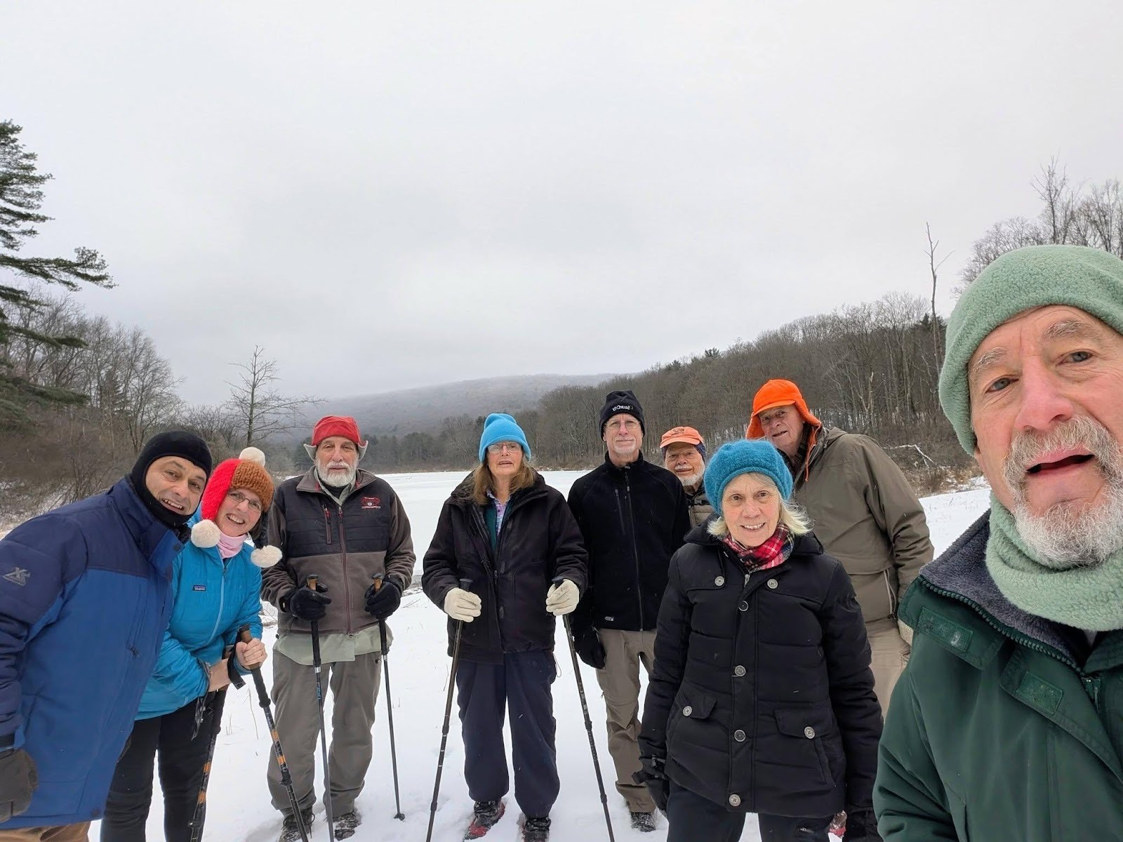
Twelve hikers met on Ekroos Rd on the Tioga/ Tompkins County line for an out-and-back road walk led by Nancy H. This is hike # 57-14 on our list of regular hike locations: https://www.ithacahikers.com/hike-57 .
Weather conditions were good, with cold temps and light snow flurries at the beginning of the hike. By the end of the hike the snow had stopped, and the sun was shining through the cloud cover.
In the past, Ekroos Rd has tended to be a reliable winter hike location, plowed for the two houses along the way but otherwise a very icy road surface. Because of this everyone was wearing foot traction during the hike; the foot traction proved to be unneeded until the very end of the hike where the road transitions to a seasonally maintained surface. The rest of the route was well plowed, and we could see where multiple blowdown trees across the road had been recently chain sawed to clear the lane of travel.
Much of the outbound leg of the hike is a gradual downhill, with the last section approaching 76 Rd to be quite steep. Along the way the road weaves in and out of Tompkins County, the road bearing three different names along the length of the route.
The road passes over several streams, which were quite active today. The road is also bisected by a snowmobile route, but we saw no snow machines or any vehicular traffic on the road today. We did see one other solitary road walker like ourselves during our hike.
There was one section of trees lining the road that’s had a broad swath of tree clearing since our last hike here. I’m not sure if this was on state forest or private land
The faster hikers on the group made it as far as 76 Rd, which they tapped before turning around and re-tracing their steps.

Hike report by Nancy H.
A dozen hikers met on Ekroos Road, which runs along the line between Tompkins and Tioga counties, for a wintry road walk. Ekroos Road, which runs alongside a gorge, is a delightful three-season hike. In winter, the bare trees allow some beautiful views into the woods and across fields. Part of the road is seasonal, so there’s little to no traffic, and at times the road seems more like a wide trail through the woods.
Light snow was falling as we set out. The road was somewhat icy, so foot traction was needed. This hike goes downhill for an hour (with some leveling off about halfway down), which means the return leg is a long, steep uphill climb. Because it’s an out-and-back that stays on one road, everyone could hike at their own pace. As we were returning to the cars, the sun emerged from behind the clouds that had filled the sky for most of the hike. A few hikers got back to the cars early, so we kept going in that direction until the full two hours were up.


Sunday, January 18
Kennedy State Forest, Virgil
Hike report by Jim
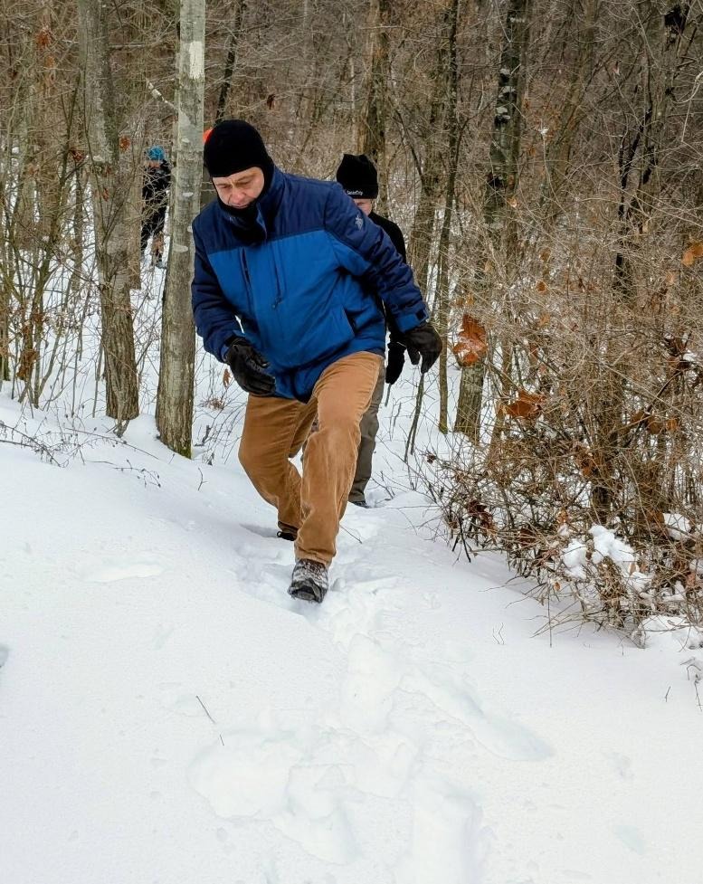
Twenty-two hikers met on Daisy Hollow Rd in Cortland County for a lollipop hike on parts of the FLT and the Swedish Loop trail in James Kennedy State Forest led by Casey C. This is hike # 40-4 on our list of hike locations: https://www.ithacahikers.com/hike-40.
There are several FLTC map sheets that cover the area of today’s hike. The map sheet with the most detail is map sheet ” The Swedish Loop Trail”, available in paper or electronic formats at : https://fingerlakestrail.org/…/purchase-individual-maps/ . Sale of the map sheets helps to defray the on-going costs associated with trail maintenance.
Today’s hike took us through an area where we’ve had several recent large blowdowns across the trail, but they’ve all been dealt with by trail maintainer Alex Gonzalez, who does a great job maintaining this section of trail.
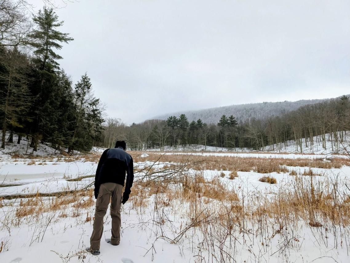
While Tompkins County hasn’t seen much snow depth in recent days, Kennedy Forest still has a decent quantity of hard crusty snowpack along the trails we hiked today. This particular hike is always known for the many roots that run across the footpath that can be a hazard to hikers in the winter and rainy summer days. Today we took our time on the outbound leg, carefully picking our way along the trail that runs for much of the hike along and across a nice running stream.
About a mile into the hike, we reached the first intersection with the Swedish Loop trail. We continued on the FLT until we reached the yellow blazed Stockholm Short Cut Trail. This trail cuts back across the stream to the Swedish Loop Trail.
The group took the Swedish Loop Trail back to the FLT. Traditionally this hike always runs around fifteen minutes short, so in an effort to make up that time Casey turned the group around and returned to the FLT along the Swedish Loop and Stockholm Short Cut Trail.
Once back at the first intersection of the FLT and Swedish Loop Trail the group returned to our cars without incident. On the return trip the trail surface was much easier to traverse now that the surface has beaten down. We got back to the cars at our normal hike duration thanks to Casey’s route modifications!
We did encounter one small group of day hikers on the trail but otherwise has the hike to ourselves.
Warm welcome to John, Brenda and Fiona who joined the group for their first hike today!
For those hikers who are tracking their FLT miles for a 2026 FLT50 or FLT100 patch, todays hike included three FLT miles.